The mission of the Alberta Geomatics Historical Society is to collect, preserve and share the history of land surveying in Alberta.
From early surveyors like David Thompson, who mapped vast uncharted territories, to surveyors today who use GPS and GIS technologies, surveyors have laid the foundation for settlement, land development and resource management.
The Dominion Land Survey facilitated orderly settlement and development in western Canada. Surveying the lands of First Nations and Metis settlements was critical for recognizing and formalizing indigenous land rights. Surveys for resource development have enabled effective management of natural resources, driving economic growth.
As Alberta continues to grow, the role of surveyors remains essential, contributing to the province’s progress.
FEATURE ARTICLES
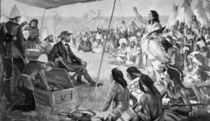
Early Surveys of First Nation Reserves in Alberta
The first surveys of reserves for First Nations in what was to become the province of Alberta were carried out in 1878 by Dominion Land Surveyors William Ogilvie and Alan P. Patrick.
Read More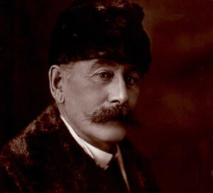
Allan Poyntz Patrick, PLS, CE, DLS/DTS, LS(BC), JP, ALS.
This summary of AP, as some of his friends called him, outlines the life of an Alberta Land Surveyor with one of the longest survey careers in Canada, spanning from 1869, when he articled with Robert Sparks, PLS, in Ottawa, Ontario, until he fell down some stairs in his Calgary home in 1943 at the age of 93.
Read More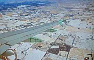
The Dominion Land Survey System
The Dominion Land Survey facilitated the rapid and orderly settlement of the West. The system, consisting of meridians, base lines, townships, sections, range and township roads, and correction lines, is likely the largest block of land ever surveyed under a single unified system in the world.
Read More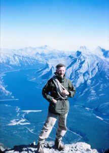
Matt Wuhr Interview July 8 1999
Matt spent most of his career surveying in the Arctic and surveying Indian Reserves and national parks in Alberta. The Alberta Geomatics Historical Society has nearly 1,600 color photographic slides that he took while doing his surveys. He was interviewed by Les Frederick on July 8, 1999.
Read More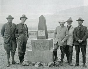
The Survey of the Alberta-British Columbia Boundary 1913-1924
Part of the boundary between Alberta and British Columbia that followed the continental divide of the Rocky Mountains. For centuries it had formed a natural boundary for First Nations and fur traders.
Read MoreOur Gold Sponsors