The Evolution of Land Surveying Technology in Alberta
These articles trace land survey measurement technology from the time of early mapping and surveying in Western Canada to the relatively recent application of GPS technology. They depict the greatest evolution in land surveying technology in history – the period from about 1960 to the early 2000s. This period witnessed the transformation in measurement technology from transit and chain to GPS, and in survey computation from logarithms to the sophisticated programs and computers of the early 21st Century. They were originally published from 2021 to 2023 in ALS News a quarterly publication of the Alberta Land Surveyors Association.
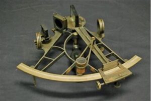
01. Sextant and Artificial Horizon
Sextants, developed in the 17th Century were used until the 20th Century to determine the...
Read More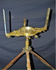
02. Circumferentors – Made in Canada before Confederation
Circumferentors were used to survey Canadian settlements and international boundaries during the 1800s. They were...
Read More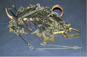
03. Gunter’s Chain – a legacy of three centuries
Imagine designing something that would be used for three centuries. That is what Edmund Gunter...
Read More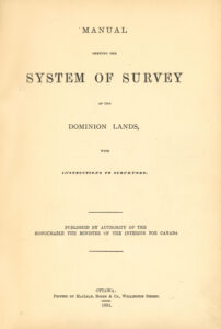
04. Manuals of Instruction for the Dominion Lands Survey
In 1871, the survey of public lands commenced in what was then called Manitoba and...
Read More05. Surveys were to be Astronomical
It was common to use magnetic bearings for surveys during the 19th century using a...
Read More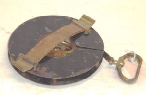
06. The Gunter’s Chain is Replaced by the Steel Band Chain
When the first township surveys in Western Canada were carried out, the Gunter’s chain was...
Read More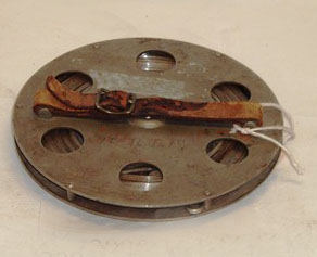
07. Chaining – an Art and a Science
Steel band tapes, when introduced, were called chains and the act of measuring using a...
Read More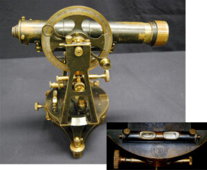
08. The Topley Company – a Canadian Supplier of Survey Instruments
The Topley Company – a Canadian Supplier of Survey Instruments
Read More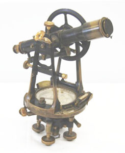
09. Is it a Theodolite or Transit? Early Open Vernier Theodolites and Transits
What is the difference between a theodolite and transit? The term “theodolite” can be traced...
Read More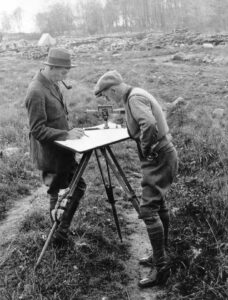
10. The Survey Instrument Captain Cook Wanted to Learn – The Plane Table and Alidade
The plane table and alidade has been used for mapping topographical features for centuries.
Read More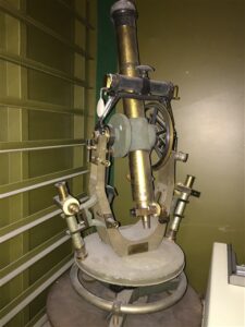
11. Early Geodetic Theodolites were King
The Geodetic Survey of Canada was officially established in 1909 with William Frederick King as...
Read More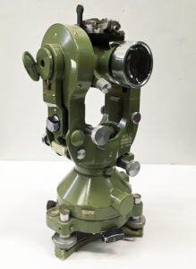
12. Wild – The Leader in Optical Theodolites
The story is that, in 1902, Heinrich Wild, a 24-year-old Swiss surveyor stood behind his...
Read More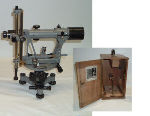
13. Kern – 170 Years of History
Kern & Co. was founded in 1819 by Jakob Kern in Aarau, Switzerland. Jakob Kern...
Read More