01. Sextant and Artifical Horizon
By Gordon Olsson
Sextants, developed in the 17th Century were used until the 20th Century to determine the angle between a celestial object and the horizon to find latitude in sea navigation. At sea, the natural horizon is represented by the sea surface and the sky.
Mapmakers and surveyors such as David Thompson working inland also used the sextant to determine latitude.[1] On land, an artificial horizon provided the level surface as the surveyor was unable to see the actual horizon due to the terrain. Mercury was placed in the container to create a level surface and a reflection. To measure the altitude of a star above the horizon, the star and the image of the star in its reflection in the mercury is superimposed. The angle measured is a double altitude which is divided by two to obtain the actual altitude.
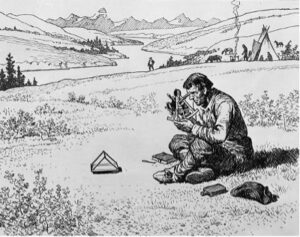
David Thompson Taking an Observation
Charles William Jefferys
Library and Archives Canada
C-073573
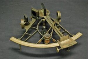
This sextant was made by Spencer Browning & Co. London. The company was in business in London from 1840 to 1870 indicating that the sextant is at least 150 years old.
Purchased
ALSA 2010.10.01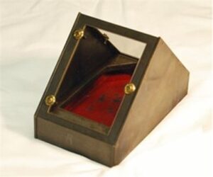
This artificial horizon was made by Fauth & Co. Washington, DC. It comes with a wooden carrying case and includes a metal bottle for mercury which was placed in the container shown in the image to replicate a horizontal surface. Fauth & Co was established in 1874 and the company name was kept on instruments until 1905 indicating this item is over 115 years old.
Purchased
ALSA 2010.10.02
This sextant and artificial horizon were used in 2008 to take observations enroute by the David Thompson bicentennial brigade team that paddled from Rocky Mountain House to Fort William, Ontario. The purchase of these objects was made possible by a monetary donation by the Alberta Historical and Educational Foundation for Land Surveying (Surveyors Historical Foundation).
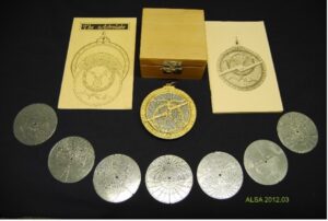
Another instrument made for navigation was the astrolabe introduced by the Arabs in the 10th Century. This one in the collection is a replica and, while it doesn’t relate to the history of land surveying in Alberta, it has been retained in the collection because of its general interest. Less than one hundred original astrolabes are known to survive and most of these are in poor condition having been recovered from shipwrecks.
Donated by Len Olson, ALS
ALSA 2012.03.01
Sources of Information:
- Peter Ifland The History of the Sextant, Talk given at the University of Coimbra,Portugal, October 3, 2000.
- September 2011 issue of ALS News. “Sextant on Display in ALSA Office”
[1] A.O. Wheeler The Selkirk Range, page 184. Wheeler writes of a large brass sextant, one of Dollond’s (a manufacturer of mathematical and surveying instruments in London, England) of ten-inch radius, reading to fifteen seconds which Thompson used constantly.
Author: Gordon Olsson, ALS (Hon. Life)
August 25, 2021
Copyright 2024 © Alberta Geomatics Historical Society
